 Feasibility Fast
Sample report
What you get for $99
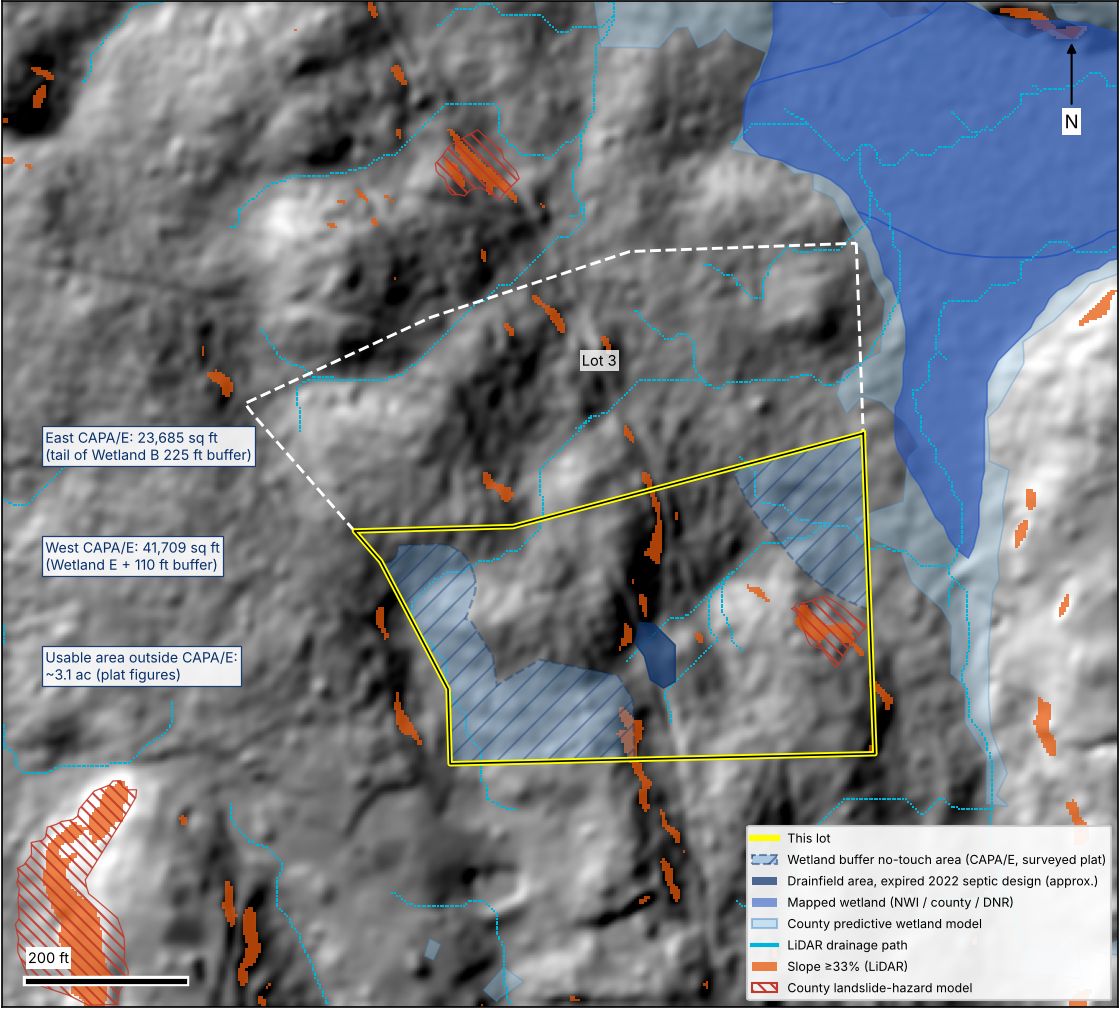
Below is the summary page from a real screen, with the address and parcel number taken out, and one of the maps we drew for the lot. It's only the first page. The full report runs 6 to 10 pages, with a section for each item, every source we used, more maps, and a site-work cost range.
Page 1 only: the summary
4.6-acre lot in a proposed subdivision
Overall CAUTIONRural residential zoning, Western Washington. Buyer planning a single-family home.
- Plat statusSTOPThe lot exists on a surveyor's drawing but not yet in county records. It becomes a legal lot only when the final short plat records, and the county sent the plat back for corrections.
- ZoningCAUTIONOne home is clearly allowed. A detached ADU depends on the lot recording at the minimum size, and the plat shows only 236 sq ft to spare.
- Critical areasCAUTIONWetlands were delineated and buffers approved by the county. About a third of the lot is a permanent no-touch area; about 3.1 acres remain usable.
- SepticCAUTIONThe soils passed septic review, but the designs have expired. Budget for a new design, likely a pressure-distribution system.
- WaterGOPublic water is in the road.
- PowerCAUTIONPower reaches the adjacent lot. Moves to GO once the utility or seller confirms service at this lot.
- Access and titleCAUTIONLegal access is solid by recorded easement. The developer's loans must release the lot at closing, and the promised HOA isn't on record.
- TopographyGONo slope concerns in the likely building area.
- Site-work costCAUTIONRoughly $65,500–130,500 of lot work and fees before the house itself.
Bottom line
One of the better-prepared rural lots we see, but not buyable yet in the normal sense. Sign only a contract that closes after the final plat records, and treat the ADU as dependent on the recorded lot area.
Every finding above gets its own section in the full report, with the records behind it and what to do next.
From the same report: critical areas map
Looking at a piece of land?
Send the parcel number now. You don't need a contract. You'll have a go, caution, or stop answer in 24 hours.